
Before the Haze Arrives: CSU's RADSENSE Project Is Forecasting Wildfire Smoke in Real Time
CSU team uses deep-learning to better protect public heath


The view from the top of Colorado State University’s Powerhouse Building in Fort Collins, Colo., is spectacular. Beyond the tree-lined campus, the view extends to the peaks of the Rocky Mountains. Just a few weeks ago, the view was very different. Smoke from fires burning in western Nebraska covered most of Colorado’s Front Range in a dense haze of smoke. The mountains were invisible, and the smoke, which lingered for days, forced many people to shelter indoors.
This is an increasingly common occurrence in the western United States, with smoke originating from fires both local and as far away as California and Canada.
In 2025, a record fire season meant that smoke days - depending on the definition - measured between several dozen to over a hundred. This represents hundreds, and potentially thousands, of hours during which people were exposed to unhealthy levels of air pollution.
John Volckens, a professor of Mechanical Engineering and the Director of the Center for Energy Development and Health at CSU, is up on the roof with me, along with several other members of his research team, including Shantanu Jathar, an Associate Professor of Mechanical Engineering and an expert in air pollution.
Jathar predicts that “over the next decade, we will see a significant increase in wildfire activity and smoky days. This means communities are going to be exposed to higher amounts of smoke, for longer periods of time.”
“Yet,” Volckens notes, “our ability to monitor and predict the transport, magnitude, and timing of wildfire smoke remains extremely limited. For example, state-of-the-art forecast models explain less than a third of the variability in smoke concentrations.”
“Right now, the best indicator that you're going to have a wildfire smoke day is whether yesterday was a wildfire smoke day.” Professor John Volckens.
The study of wildfire and wildfire smoke has been largely retroactive. Researchers gather and analyze data after the fact in an attempt to understand what happened and its consequences. Volckens and his team are working to get ahead of the smoke and instead predict where wildfire smoke will be, and its severity, before it reaches populated areas. With a smile and good humor, he says, “It turns out that air quality forecasting is a lot harder to do than regular weather forecasting.”
The RADSENSE Project
The RADSENSE (Rapid Analytics and Deployment of Sensor Networks for Emergencies) project is using a combination of cutting-edge in-situ air sensors and data from satellites and physics-based models to train a deep-learning algorithm. Using this algorithm and real-time sensor information, the goal is to produce the first-ever wildfire smoke models and forecasts that can be used to inform personal and public health decisions.
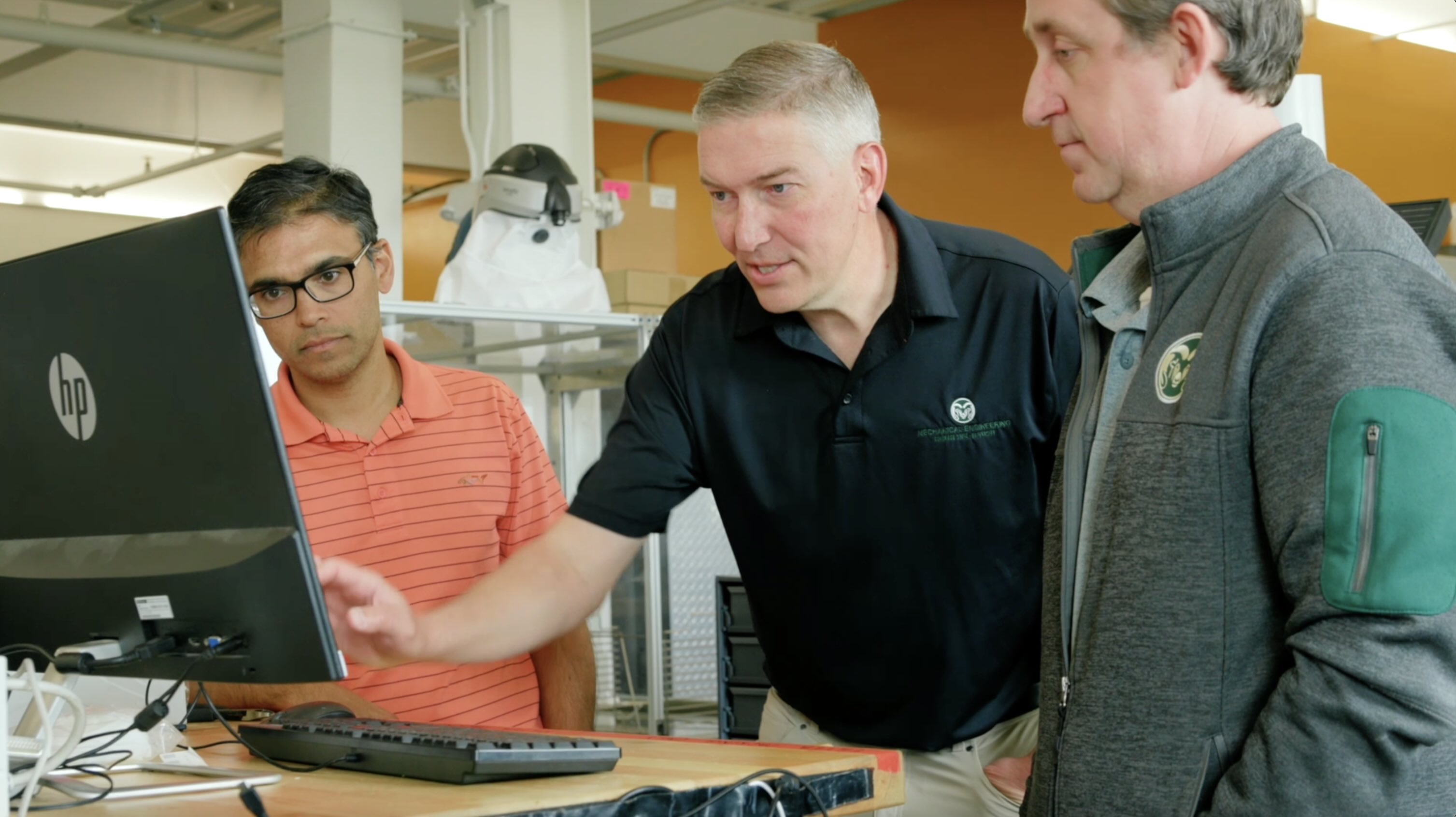
“We're collecting data, aggregating it, and making smart models to predict what the air pollution in the future might be like,” explains Associate Professor Christian L’Orange, an expert in air quality monitoring and engineering for human health. The desired outcome is information that will help people make informed choices to limit their exposure to harmful wildfire smoke.
Establishing the RADSENSE Network
As Volckens inferred, achieving this outcome is harder than it sounds. The first part of the RADSENSE project involves physically deploying twenty-five specialized air sensors at various points along the Front Range from Cheyenne to Pueblo.
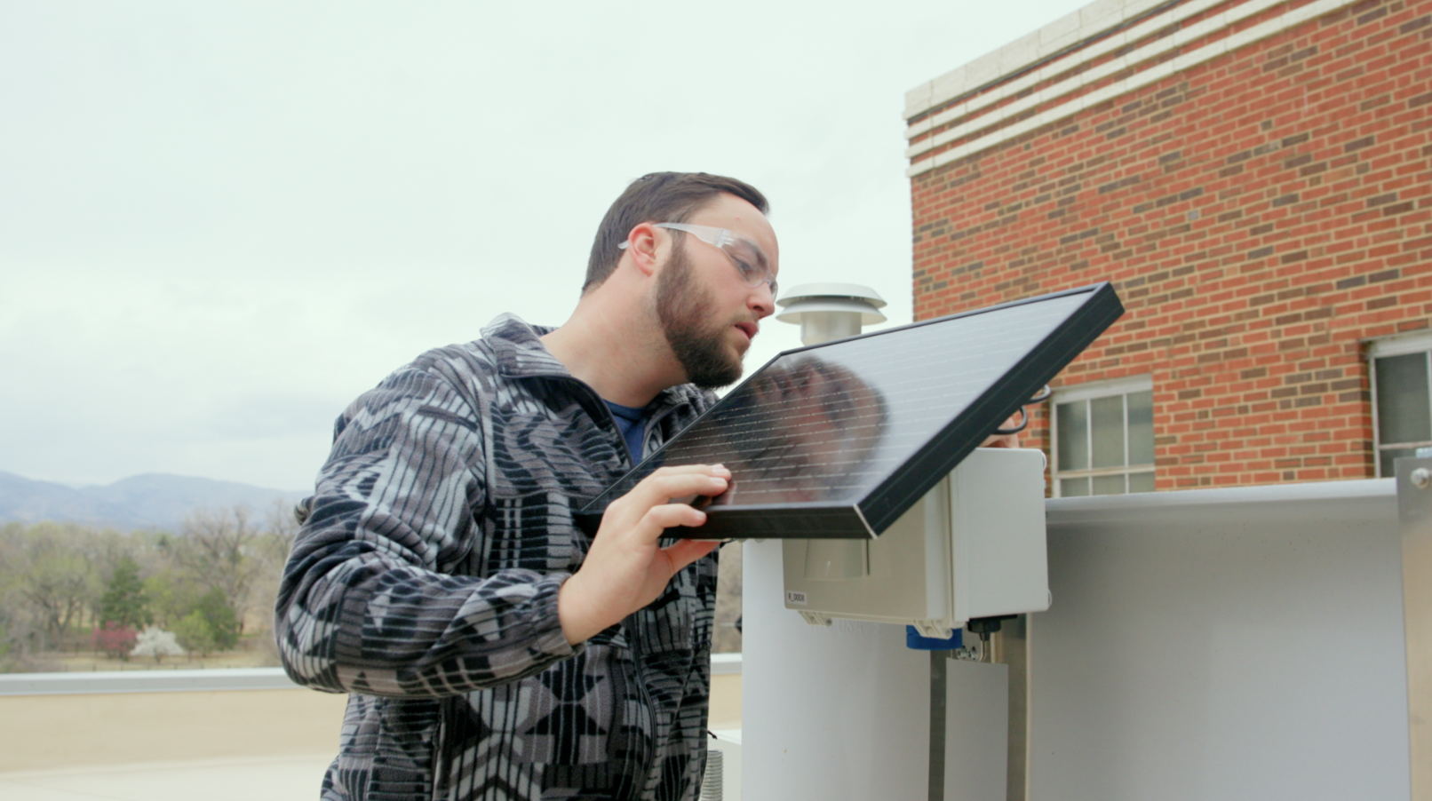
These sensors, called AirPens, are the reason I am up on the roof.
Perched along a railing are a handful of test units that look like high-tech birdhouses; small solar panel roofs cover weatherproof boxes. Inside each unit is an AirPen, along with additional technology such as a GPS and both a cellular and Bluetooth radio. The setup allows the AirPens to be deployed nearly indefinitely in a low-power standby mode until activated by researchers. Built from components found in the average smartphone, these small sensors cost a tenth as much to produce as a traditional air quality monitor.
Global Data with Local Impacts
Once distributed across the Front Range, the RADSENSE units will remain dormant until activated by researchers during a smoke event.
The real-time and hyper-localized data coming from the monitoring stations can then be combined with information pulled from a variety of other sources.
“We're pulling data from everywhere that we possibly can,” L’Orange tells me. “Some of our major data sources are the EPA air pollution networks that currently exist, data streams that we'll be creating as part of the monitors that we've developed over previous years, existing forecasting models, and meteorological weather predictions.”
The RADSENSE team participated in the NSF ASCEND Engine hackathon last year with NVIDIA to strengthen their modeling approaches. "The hackathon experience was tremendous for us,” said Volckens. “It really helped us jumpstart our AI modeling efforts. We got to pair up with leading experts in AI modeling and deep-learning models. They helped us really accelerate. What we were hoping to do over a period of months, we got done in days, and so that really helped us hit our milestones faster and accelerate progress on our modeling engine.”
This summer, the team will work on integrating their sensor network data with a specialized machine-learning algorithm to create models capable of predicting wildfire smoke up to 48 hours in advance. This kind of notice would allow schools, event managers, and city planners to make public health decisions with earlier and more accurate information. Outdoor events could be moved inside or rescheduled, and cities could notify their populations about which days are safe to go outside and when it is better to stay indoors.
“Just like humans can learn from mistakes, we train smoke models to learn from their mistakes,” says Zongrun Li, a recent PhD graduate and expert in air quality modeling. Li’s role in the RADSENSE team is to feed all the collected data into models to better predict wildfire smoke emissions, transport, and subsequent exposures. “Over time, the models get smarter and more accurate,” says Li.
Public Health and Economic Impacts
Wildfire smoke has severe health consequences, especially for vulnerable populations such as children, the elderly, and individuals with pulmonary conditions.
“Smoke particles, when you inhale them, can lodge in the respiratory system, and can make it into the cardiovascular system,” Associate Professor Shantanu Jathar tells me. Jathar leads the Laboratory for Air Quality Research at Colorado State University and is a Co-Investigator on the RADSENSE project. “Typically, people who are exposed to wildfire smoke experience full-body effects, with increased risk for lung cancer, cardiovascular disease, asthma, and COPD."
“I think it's important to communicate the health effects associated with this smoke, and our forecasting models will allow communities to be prepared for these smoke events and take actions to reduce their exposure.” - Shantanu Jathar
In addition to individual harm, smoke also causes billions of dollars in economic damages through premature mortality, increased hospital admissions, lost productivity, and canceled events.
The RADSENSE project brings together a suite of technologies that will “enable more rapid, efficient, and effective decision-making in response to air quality disasters affecting the health, welfare, and productivity of millions of Colorado residents—and millions nationwide.”
How this Project Fits in with the NSF ASCEND Engine
The U.S. National Science Foundation ASCEND Engine in Colorado and Wyoming is a federally funded Regional Innovation Engine that harnesses advanced sensing, computational modeling, and AI-powered decision support to deliver scalable, real-world solutions to the challenges of wildfire, drought, and extreme weather. ASCEND stands for Advanced Sensing and Computation for Environmental Decision Making - a name that describes the data value chain the Engine is building, from the first sensor reading to the final decision made by a utility manager, city official, or family deciding whether to let their kids play outside.
The RADSENSE project is a good example of the ASCEND framework in action. The AirPen sensor network represents advanced sensing - the capture of high-quality, hyper-localized environmental data. The deep-learning forecasting models represent computational analytics - turning that raw data into something meaningful. And the 48-hour public health forecasts are the decision-support tool: the point where science reaches the people who need it. This three-part pipeline, from sensing to analysis to actionable intelligence, is precisely what the ASCEND Engine was designed to build.